
Enterprise ZIPs in Parcel Records
Clark County parcel and map research confirmed the four ZIPs below in Enterprise context. This is a non-exhaustive set of official samples and boundary research, not a declaration that these are every ZIP whose polygon might touch the Enterprise CDP, TAB, or planning area. Each row uses Las Vegas as the postal city because that is the reported mailing city, while the legal town must still be checked on the specific Assessor or OpenWeb record.
| ZIP | Areas Covered | Postal City | Verification Note |
|---|---|---|---|
| 89139 | Enterprise parcel samples; local-area leads include Pinnacle Peaks/Sonata and the southwest Silverado Ranch/Rainbow/Blue Diamond corridor | Las Vegas | Non-exhaustive. Confirm the address with USPS and the Assessor City/Town field. |
| 89141 | Southern Highlands and south Enterprise parcel context, including official Enterprise samples | Las Vegas | Non-exhaustive. ZIP, CDP, and TAB boundaries differ; verify each address. |
| 89178 | Mountain's Edge and Gomer/Fort Apache vicinity as address-context leads | Las Vegas | Non-exhaustive. Confirm the parcel's legal town and current USPS result. |
| 89179 | South Enterprise growth-area parcel context; exact subdivision and road vary | Las Vegas | Non-exhaustive. Address-by-address checking is required. |
The postal city column does not establish local government. Enterprise is an unincorporated Clark County town, so the parcel's legal City/Unincorporated Town entry is the better jurisdictional clue. A ZIP is still valuable, but only as one field in an address record.
Enterprise Postal and Legal Labels
A Las Vegas, Nevada mailing address can belong to an Enterprise parcel. The Assessor and OpenWeb samples in the research show the useful contrast: a postal line may read Las Vegas with one of the four ZIPs, while the legal City/Unincorporated Town value reads Enterprise. The difference follows the functions of the records. USPS assigns a mailing format; County parcel systems identify the legal town for land administration.
Do not turn a ZIP into a municipal boundary or a person-level result. ZIP polygons may cross CDP, TAB, planning, and other map areas. The Clark County ZIP boundary service has a ZIP display field and supports map queries, while the SNGIS boundaries service supplies related mapping context. Neither geographic polygon proves incorporation or residence.
Verify Enterprise Postal ZIP
Use the USPS ZIP Lookup with the full address to check the current mailing ZIP and city. Record the lookup date because routing and last-line labels can change. USPS verification is the mail-format step, not the final location determination. Then compare the result with the Assessor's address search and its City/Town selector.
Leaving the Assessor City/Town filter unspecified can help when the only known form is the Las Vegas mailing line. Once the parcel appears, use its legal-town value and exact situs text. If the address does not return, retry the direction and street-type variants before deciding that the postal ZIP or locality is wrong.
Note: A current USPS response validates a mailing format, while the County parcel card supplies the legal-town and parcel evidence for the same address.
Match Enterprise ZIPs to APNs
The APN is the bridge between a postal ZIP and County land records. Clark County's direct parcel search requires an 11-digit parcel number, with current-record or present-and-prior-owner choices. Keep any hyphenated display form in notes, but follow the portal's entry instruction for the digit format. An APN is not a street number and its segment meanings were not established in the research.
The assigned APN-search capture is a useful visual reminder of the County parcel route.
Open the Clark County Assessor APN search before entering the parcel key.
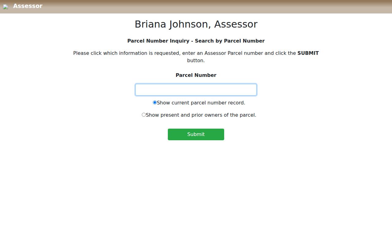
After an APN returns, compare the situs address, mailing line, City/Unincorporated Town, subdivision, and map links instead of relying on ZIP alone.
For example, the research's official samples place an Enterprise parcel in 89139, Southern Highlands examples in 89141, and a Mountain's Edge context example in 89178. They are verification examples, not lists of people or proof that every address within those ZIPs has the same legal-town field.
Enterprise ZIP Search Workflow
A ZIP narrows a geographic question, but the County systems do not provide a ZIP-wide resident roster. Use the postal check to normalize one address, then move from the parcel's legal location to its APN and map context. This process is more precise than assuming all addresses carrying one postal label belong to the same legal area.
- Validate the complete address with USPS and record the returned mailing ZIP and city.
- Search the Clark County Assessor address form, checking the City/Town value and the official situs spelling.
- Copy the 11-digit APN and retain the current or present-and-prior record setting that was used.
- Open the APN in OpenWeb to compare parcel geometry, County layers, and linked record routes.
- Use the Recorder index only when a recorded-document question remains, and keep its document date separate from the postal result.
When the ZIP has been narrowed to a street and exact address, the Enterprise street directory supplies the fuller address-to-parcel and recorded-document method.
Enterprise ZIP Filter Limits
Official ZIP-capable systems have different purposes. The County's business-license eligibility search exposes a ZIP mode, but it returns business and license information rather than a resident list. The Assessor address form is built around street and City/Town fields, not a ZIP-wide people query. OpenWeb can display or query ZIP polygons and parcels, but a mapped parcel is not a person roster.
| Official source | ZIP action | What it can return | Limit |
|---|---|---|---|
| Clark County business-license eligibility search | ZIP is an exposed search mode | Business and license records | Not a ZIP-wide resident search |
| Clark County Assessor address form | Street and City/Town controls | Parcel-related address results and APN route | No ZIP-wide resident search exposed |
| Clark County OpenWeb | Display or query ZIP polygons and parcels | Geographic and parcel context | Does not create a person roster |
| Clark County Elections reports | District and precinct files, not a captured ZIP field | Election geography and published reports | A ZIP or CDP does not safely determine a voter precinct |
Clark County Registered Voter Services is an individual status route with protected controls. Its captured materials do not support a ZIP-based resident workflow, and published election totals should not be recast as Enterprise ZIP counts.
Enterprise Mountain's Edge Timing
ZIP 89178 is useful address context for Mountain's Edge, but it is not an all-purpose neighborhood boundary. Clark County describes Mountain's Edge as an approximately 2,500-acre planned community south of Blue Diamond and west of Rainbow. The County says it was approved in September 2002, and its development agreement was canceled in January 2022 after later changes.
This chronology explains why older Las Vegas regional maps or directories may not show a modern Enterprise subdivision street. A parcel card's construction year, subdivision, plat, and recorded documents provide better address-specific timing. The historical material is context, not proof that a particular ZIP had a fixed boundary or a constant set of addresses.
Enterprise Boundary Map Dates
The official Clark County ZIP boundary map is dated November 22, 2025. Save that revision date with any map-based finding. The County GIS catalog also provides Valley ZIP and Enterprise TAB map material, while OpenWeb supplies current parcel context. These sources have different scales and purposes, so one should not be substituted for the other.
For historical routing context, USPS Postal Bulletin 22129 from 2004 records last-line and routing changes involving 89178 and 89179 and groups 89139 and 89141 in Las Vegas routing data. It is not a current retail-station directory. The research did not locate a current station assignment, PO-box-only classification, or unique-ZIP classification for these four ZIPs.
Note: Treat the 2004 bulletin as routing history and use the current USPS lookup for a present mailing result.
Enterprise ZIP Research Notes
A short worksheet makes a postal finding auditable when the County map or delivery routing changes. It also keeps a postal city from being confused with a legal town or a map polygon from being presented as personal evidence.
| USPS result | Full address, returned city and ZIP, plus lookup date |
|---|---|
| County situs | Official street text and City/Unincorporated Town value |
| APN | Eleven-digit parcel key and displayed hyphenation when shown |
| Map source | County map or OpenWeb layer, revision or last-checked date, and relevant boundary caveat |
| Parcel context | Subdivision, lot/plat, construction field, or record link only when relevant |
| Source control | URL, record type, date checked, and the limit of what the source establishes |
Use one verified sample address and APN for a completed row, then state whether the conclusion is postal, legal-town, parcel, or map context.
Enterprise ZIP Legal Boundaries
ZIP code boundaries and Enterprise limits do not match one-for-one. Enterprise has no incorporated city boundary because it is an unincorporated town. Its CDP, Town Advisory Board, planning, and postal geographies can overlap without being identical. The Enterprise CDP QuickFacts and Census TIGERweb place table describe Census geography, not ZIP coverage. The safe method is to verify the individual address with USPS, Assessor City/Town, APN, and OpenWeb rather than drawing a jurisdictional conclusion from a ZIP alone.
- ZIP
- A USPS delivery and mailing geography used to format an address. It is not a municipal boundary or resident count.
- ZIP+4
- An added four-digit delivery segment used for more precise mail sorting. It does not replace the County APN.
- Carrier route
- A postal delivery grouping. It may help mail operations but does not prove a legal-town field or household relationship.
- GIS polygon
- A mapped area such as the County ZIP layer. It provides geographic context, not incorporation or individual-residence proof.
The research located no PO-box-only or single-institution ZIP touching the Enterprise sample area. That absence is not a classification finding, so current USPS details remain the appropriate check.